2014 Mount Ugo Trail Marathon
3rd Mount Ugo Trail Marathon/Half Marathon
March 30, 2014
4:00 AM-2:00 PM
Kayapa, Nueva Vizcaya, PHILIPPINES
Brought to you by frontRUNNER Magazine in cooperation with the Province of Nueva Vizcaya, Municipalities of Kayapa, Nueva Vizcaya and Itogon, Benguet and Brgy. Tinongdan
Registration Fees:
Marathon: PHP 1250.00 (inclusive of trail fees, shirt, medal and post-race meal) / USD 40.00 for foreign entrants
Half Marathon: PHP 850.00 (same as above) / USD 30.00 for foreign entrants
Registration starts on August 1, 2013 and closes DEFINITELY on MARCH 17, 2014, Monday. There will be NO extensions.
For inquiries, send email to frontrunnermag@gmail.com or call/text 0917 803 0664 or 0999 998 7654.
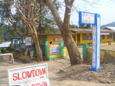
Race briefing will be held at 3:00 PM on MARCH 29 at the Kayapa Central School.
Race bibs will be distributed during the briefing or before the race starts.
Registration
- Bank Deposit: Constante C Mendoza Jr, BPI S/A 2379 0362 39. Write your name and shirt size on the deposit slip, then scan and email same to frontrunnermag@gmail.com for confirmation
- NO refund will be given for whatever reason if participant fails to attend the event.
2012 Official Results: https://frontrunnermagph.wordpress.com/2012/04/02/2980/
2013 Official Results: https://frontrunnermagph.wordpress.com/2013/04/01/official-results-2nd-mount-ugo-trail-marathon/
http://www.youtube.com/watch?v=VK9axymIEfU&feature=plcp
THERE WILL BE NO ONSITE REGISTRATION.
NO CASH PRIZES, NO FRILLS, NO LOOT BAGS, NO FREEBIES and ABSOLUTELY NO WHINING. Just lifetime memories, bliss and blisters, and a peaceful, easy feeling. Personal satisfaction guaranteed.
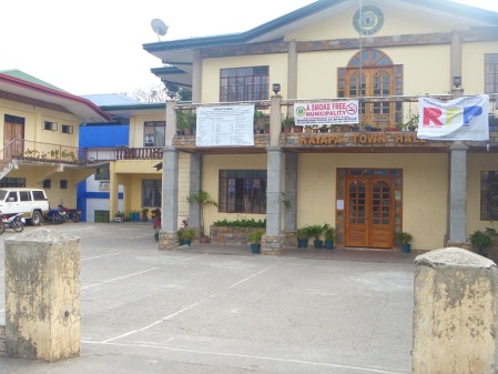
Start/Finish(All events): Kayapa Municipal Hall (1121 Meters Above Sea Level-masl)
Marathon Horn Start: 4:00 AM
Half Marathon Horn Start: 4:00 AM
Marathon Turnaround: Mt. Ugo Summit Marker (2170 masl)
Marathon Cutoff time: 10:00:00 hours
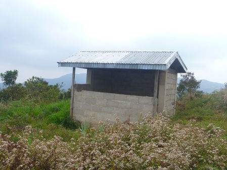
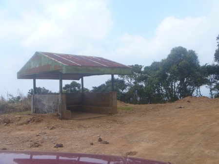
Half Marathon Turnaround: Mount Samento Waiting Shed (1835 masl)
Half Marathon Cutoff time: 5:00:00 hours
THE RACE
If you want freedom and love the outdoors, this race is for you. If you want solitude, serenity, peace and quiet, this is it.
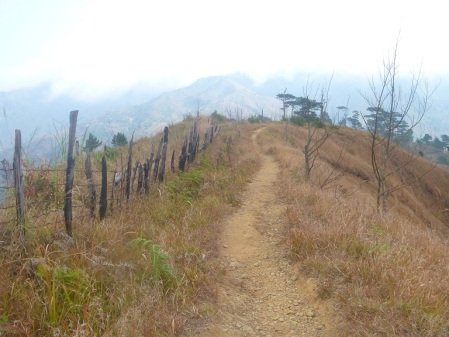
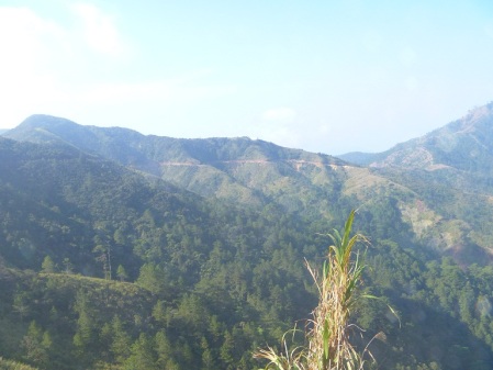
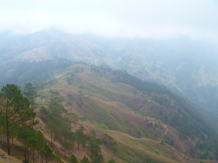
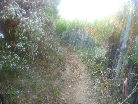
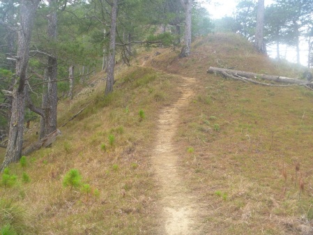
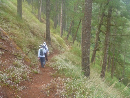
Here, you don’t have to worry about toxic car fumes, bully drivers and incessant car horns blowing in your face. There are no man-made obstacles to obstruct your path. Instead, indulge in an all-natural setting which offers fresh, unpolluted air, majestic views of pine tree-filled mountains, vegetable gardens set in terraces, switchbacks, open, single track trails, and rocks, fallen pine trees and slippery trails that will serve as natural obstacles. Cliché as it may sound, you only have the sounds of the wind, your footsteps and breathing, and insects to provide the melody as you go along.
Here, you breathe the natural scent of pine trees and free yourself from the confines of a cramped, artificially pine-scented, air freshener-filled car whose smell seemingly clings eternally to your clothes, and choking smog, you get to relive your lost youth and once again, embrace the wide and open world, and yesteryears you once truly enjoyed.
WHILE WE WILL EXERT EFFORTS TO MAINTAIN THE CLEANLINESS AND PRE-RACE CONDITION OF THE ROUTE, IT IS IMPERATIVE THAT EACH PARTICIPANT DO HIS OWN SHARE BY BEING A RESPONSIBLE TRAIL RUNNER.
PLEASE KEEP IN MIND AT ALL TIMES THE ADAGE, TAKE NOTHING BUT PICTURES AND LEAVE NOTHING BUT FOOTPRINTS. THIS IS AN ABSOLUTE RULE and BREAKING OF SUCH WILL BE A GROUND FOR IMMEDIATE AND OUTRIGHT DISQUALIFICATION FROM THE EVENT.
Not only will the organizers and locals truly appreciate your efforts but also Mother Nature herself. Be kind to everyone and everything along the path.
And for a better appreciation of trail running etiquette, you may want to look at this link; http://baldrunner.com/2012/01/18/trail-running-101-part-2-rules-on-the-run/.
And where else can this trailblazing endurance event be appropriately held but in a town aptly named, KAYAPA!
Experience sweet, uncomplicated satisfaction right here. It’s time to feed your senses.
THE ROUTE
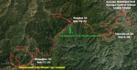
(Map courtesy of Robert Watson)
TECHNICAL DATA
http://connect.garmin.com/activity/471961010
(Courtesy of Ronnel Go)
The race takes an out and back route which starts at the Kayapa Municipal Hall and ends at the Kayapa Central School(1121 masl).
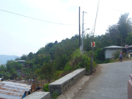
Runners will run along a concrete two-way road for about two hundred meters and into the trailhead going to TALECABCAB.
Natural spring water is our ONLY water supply source(it’s the town’s, too!) so if it is not your thing, make sure to bring your own water or tablet purifier.
PLEASE MIND YOUR TRASH AT ALL TIMES. And to further reduce trash, NO cups of any kind will be available in any of the water stations. All runners are advised to bring their own cups. Garbage bags will also be available in each water station. It won’t take too much of an effort to drop your trashes into it properly, thank you.
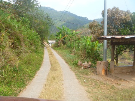
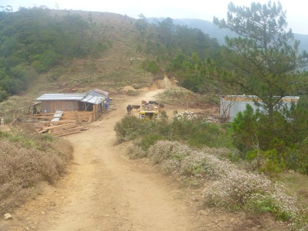
Runners then run up farther and pass through a mix of dirt/muddy(if rainy) roads and intermittent stretches of concrete tire paths until they reach TALECABCAB WAITING SHED(First Aid Station, assorted food/snacks/drinks will be available, ~ 4 kilometers), after which they shall proceed going up the winding dirt road towards INDUPIT(1866 masl, 8 kilometers) which is marked by a small settlement and a waiting shed.
Runners will run along ascending, slippery trails covered with leaves, pine tree needles and cones, and under canopies of trees at times. MAKE SURE TO CHECK YOUR LEGS FOR BLOOD-SUCKING CREATURES(limatik, small but very terrible). Simply remove them and clean with antiseptic or rub with salt. It sometimes gets messy but no need to worry.
Slower runners are advised to step aside for overtaking runners. And since this is an open, public trail, you will meet a few locals and pass through small hamlets along the route as well. Take time to greet the people you meet. ALWAYS make way for runners going up an incline. PRACTICE TRAIL COURTESY. There will be dogs, goats, cows and horses, too. Be careful.
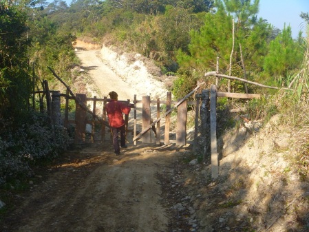
You shall be passing through gates so please close them after going through each time, thank you.
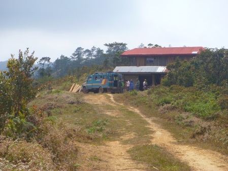
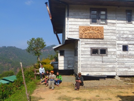
Proceed to the next landmark which is BUNDAO (Second Aid Station, 1835 masl, ~ 10 kilometers) which is marked by 2 structures – a shed and a house. Assorted food/snacks/drinks will be available. The open, flat trails stretch farther ahead and the views get only better. It’s pine trees and super nice views galore onwards.
For the 21-kilometer runners, proceed about 500 meters more until you will reach the MOUNT SAMENTO WAITING SHED where a marshal shall await and record your numbers, make a turnaround back to the finish via INDUPIT/ANSIPSIP trail and TALECABCAB Trail while marathon runners tackle the wide-open trails from this point.
BUNDAO station is your LAST aid station until you reach SADDLE/DOMOLPOS station(8 kilometers of trails away) so it is STRONGLY RECOMMENDED that you fill up your bladders/bottles and eat.
Next landmark will be the ANSIPSIP WAITING SHED (1935 masl, 12 kilometers). More mountain side, open, flat single track trails greet the runner. There will be lots of downhill running and switchbacks here as well, and the summit turnaround will be seen from here for as long as no fog will obstruct the view. As usual, ultra nice trails to die for.
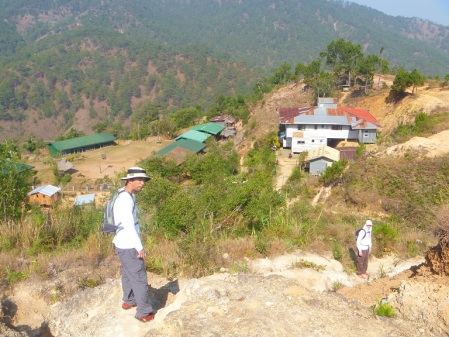
DOMOLPOS Village (1700 masl) where locals reside, is the next landmark. From here, runners run up a single track trail until the SADDLE.
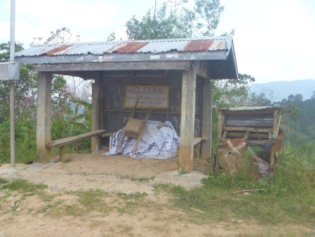
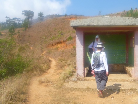
SADDLE/DOMOLPOS WAITING SHED JUNCTION(1763 masl, 17 kilometers) is where the third aid station is located. At this junction, spring water and assorted trail food will be available. It is advised that runners refill and eat. A very appropriate message is written on the shed’s wall. Be sure to take time to read it. Can’t miss, the shed is painted in pink.
From the aid station above, runners will proceed for about 3 kilometers towards the LUSOD AREA/BACUYAN JUNCTION(1770 masl, 20 kilometers) via a single track trail. At BACUYAN, runners will make a U-TURN towards the MT. UGO SUMMIT MARKER via a 1-kilometer climb aptly named, “The Terminator”.
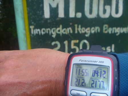
MT. UGO SUMMIT MARKER(2170 masl, 21.2 kilometers) is where a marshal shall record the names or bib numbers and arrival time. The marshals will take pictures of each runner at the summit.
From the summit, runners will proceed back the SADDLE/DOMOLPOS WAITING SHED via Bacuyan. refill or eat at the said aid station then proceed back to DOMOLPOS Village.
From the DOMOLPOS Village, runners pass through ANSIPSIP WAITING SHED, BUNDAO AID STATION and INDUPIT JUNCTION/ANSIPSIP trail again and from where they will make their finish at the Kayapa Central School via the TALECABCAB Trail(last aid station until the finish line, ~ 38 kilometers).
In total, there is only one kilometer or less of concrete, winding roads that comprises the marathon and half marathon route and the rest is all dirt roads/trails. There is significant altitude gain and loss as well.
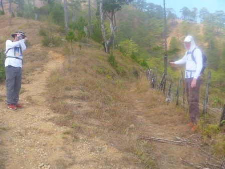
All waiting sheds/junctions/forks will be marked by ribbons or manned by marshals. Whenever you reach a junction/fork, make sure to look for ribbons tied on grass, trees or fences, and proceed from there. If you happen to enter a junction/fork and you do not see a confidence marker after running about 300 meters, return to the area where you last saw a ribbon and locate the area where subsequent ribbons are. NO time credits will be given for any runner lost. It is the personal responsibility of each runner to familiarize himself with the route. BE ATTENTIVE to markers.
Wooden KOTM kilometer markers are also in place and planted every about one kilometer until the summit, to include permanent wooden directional signs at strategic forks.
Again, to help preserve the area, please DO NOT LITTER. The only “authorized” trashes are horse and cow dung which are abundant along the route so beware. If you need to go, there are lots of grassy areas and tree trunks are wide enough to cover your behind. Beware of staying too close to ravines, though. Dispose off your wet wipes properly.
Strong winds buffet the area from time to time and the weather is unpredictable, so it is wise to bring warm and dry clothing/accessories.
There will be NO drop bag stations. Also, NO support vehicles are allowed at any point of the race.
A baggage counter at the start/finish line will be available.
For best traction, trail shoes are highly advised.
Cellphone signals exist(Smart and Globe only) but are intermittent. You may contact these numbers for any concerns; 0917 803 0664 and 0999 998 7654.
Music players are allowed but NOT recommended. Cameras are! The designated cutoff times are such that runners may be afforded the luxury and time to take pictures and savor the moment and surroundings.
NO registration fee refunds will be given for WHATEVER reason.
NO unregistered pacers, guides and bandits allowed.
NO cheating, please. I sincerely wish that this will be the last race ever that I will be reminding participants of this matter. After all, we are all decent, mature and responsible individuals, aren’t we? Besides, the route was designed in such a way that any “shortcuts” will only make the route longer.
Any complaint on cheating must be made WITHIN 24 hours after the close of the race and must be made in writing, signed and submitted to the RO/RD for proper action. This must also be accompanied by a visual proof/s of the alleged cheating. Any complaints after the 24-hour period will NOT be entertained.
The Race Organizer and Director reserve the right to modify race rules and cancel the remainder of the race while it is in progress at any time for the benefit, safety and welfare of the participants.
RECOMMENDED GEAR for all events
- Cellphone (fully charged and with load)
- Light jacket or arm warmers and head covers
- Functioning flashlight or headlamps
- At least 1.5 liter capacity hydration bag or belt bottles
- Whistle
- First aid kit(antiseptic, band aid, cotton, salt, loperamide tablets)
- Extra food or energy gels
- Wet wipes
Trekking poles allowed but NOT mandatory.
ROUTE LANDMARKS: Kayapa-Mt Ugo-Kayapa
(Owing to the terrain, distances are just approximations based on GPS measurements)
- Kayapa Town Hall (1121 masl) to Talecabcab Waiting Shed( ~ 4 kilometers)
- Indupit junction/Ansipsip foot trail (1866 masl, ~ 8 kilometers
- Bundao (1835 masl) ~ 10 kilometers
- Mount Samento Waiting Shed ~ 10.5 kilometers*TURNAROUND 21K
- Ansipsip waiting shed (1935 masl) ~ 15 kilometers
- Domolpos Village (1770 masl)
- Saddle/Domolpos waiting shed (1763 masl) ~ 17 kilometers
- Bacuyan junction (1844 masl) ~ 20 kilometers
- Mt. Ugo Summit marker (2170 masl) ~ 21 kilometers *TURNAROUND 42k
- Indupit junction/Ansipsip foot trail (1866 masl) ~ 34 kilometers (from here, 42k runners will proceed to the Finish Line via the Talecabcab Trail
- Kayapa Central School (1121 masl) ~ 42 kilometers
THE SUB-3 HOUR CHALLENGE
A special award awaits any runner who will finish the marathon in 2:59:59 hours or better.
How to get there: KAYAPA
Kayapa, Nueva Vizcaya is a small and quaint, peaceful and serene, and vegetable-producing mountain town nestled about 1121 meters above sea level, 80 kilometers away and a comfortable 2 to 3-hour drive from Baguio City through the Benguet-Nueva Vizcaya Road(also known as Ambuklao Road). The town is located at the boundary between Benguet and Nueva Vizcaya and is the gateway to Region 2 if coming from the west. The zigzag road is completely paved and offers spectacular views of Ambuklao and Binga Dams, rivers, lakes, pine tree-clad mountain sides, vegetable garden terraces and very cool and unpolluted weather. In fact, the abundance of pine trees will give you the chance to breathe real pinetree-scented air.
If you are flying to the Philippines, the main entry point to Manila is the Ninoy Aquino International Airport(NAIA) and from there, you may take regular and air-conditioned buses with terminals in Pasay, Cubao, Caloocan and Sampaloc in Metro Manila. Take those bound for Baguio or Nueva Vizcaya. Buses are available on a 24-hour basis.
Alternatively, you may fly in at the Diosdado Macapagal International Airport(DMIA) in Clark Field, Pampanga and take a bus bound for Baguio at the Dau Terminal.
From Baguio, you may take the buses and vans that regularly ply the route. Old school buses(Bambang/Belance/Dupax-bound) and vans are either located at the Dangwa Terminal or Slaughter House compound. Bus trips start at 8AM up. Fares vary from 115php to 150php.
Should you miss the regular trips, you may hire a van or taxi going to Kayapa.
Kayapa can also be reached by car via Aritao, Nueva Vizcaya passing through the Maharlika Highway. Aritao is some about 220 kilometers and 6 hours away from Manila through NLEX, SCTEX and Nueva Ecija or Bulacan if exiting at Sta. Rita in NLEX.
From Aritao, Kayapa is an hour or so away and a 29-kilometer zigzag drive up via Benguet-Nueva Vizcaya Road which connects the 2 provinces. Ample road directions guide the travelers.
Another option is to stop in Bambang, Nueva Vizcaya which is 15 kilometers after Aritao and take the buses or vans bound for Baguio at the bus parking area near a gasoline station along Maharlika Highway. From Bambang, Kayapa is an hour or so away.
There are only a few bed and breakfast type lodgings, home stays to be precise; (Tessie Baltazar-0947 172 8752/0921 988 8803, Edna Camilo-0928 989 9608 and Barangay Pangpang Hall- 0929 844 8481) in Kayapa which offer only basic necessities. Rates start at 200php per bed and cooked meals of your choice may be arranged with the landlord. You may want to reserve early as there are only limited bed spaces. Room-sharing is the norm. All are within walking distances to the starting line.
The town hall is also open for your boarding. It’s free but you have to bring your own beddings. It has toilet and bathroom facilities.
Or you may want to camp out for free at the Parish Church area where you can also park your vehicles some 300 meters away from the start.
Food is not a problem as there are a number of small eateries at the town center. There are also a number of stores from where you can buy bottled water, snacks and other food, and other personal necessities. Practically everything you will need is within walking distance.
And before you head for home, be sure to buy fresh produce at giveaway farm prices and local products at the market.
There are NO water refilling stations, cable television and internet connections in Kayapa. An FM radio signal from Baguio exists.
Lastly, a strict NO SMOKING policy exists in ALL of Nueva Vizcaya, You have been forewarned.
Again, please respect the environment, locals, rules and guidelines at all times, thank you.
I am hoping that some runners will find Kayapa to their liking, enough to make it their kind of refuge and Eden. Perhaps, not a few will be coming back for a private visit.
Kayapa is perfectly isolated somewhat but in a nice way.
Kayapa is my kind of town. Make it yours, too.
P.S.
And with all due respect, the Race Organizer’s and Director’s word is final.









December 29, 2013 at 7:03 pm
[…] o 3rd? Mount Ugo Trail Marathon – March 30, 2014 4am (Php […]
February 24, 2014 at 3:05 am
[…] https://frontrunnermagph.wordpress.com/2013/08/01/3rd-mount-ugo-trail-marathon/ […]